


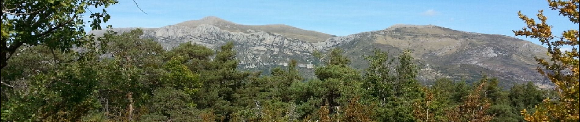
Gorges du Verdon - La-Palud-sur-Verdon - Tour de la cime de Barbin

Orcal37
User GUIDE
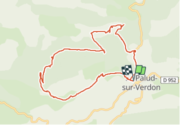

Length
13 km

Max alt
1460 m

Uphill gradient
538 m
Km-Effort
20 km

Min alt
941 m

Downhill gradient
537 m
Boucle
Yes
Creation date :
2014-12-10 00:00:00.0
Updated on :
2021-09-10 15:45:03.27
4h15
Difficulty : Medium

FREE GPS app for hiking
 SityTrail
IGN / Geographical institutes
SityTrail Plus
The world is yours!
About
Trail Walking of 13 km to be discovered at Provence-Alpes-Côte d'Azur, Alpes-de-Haute-Provence, La Palud-sur-Verdon. This trail is proposed by Orcal37.
Description
Gorges du Verdon - Départ de La-Palud-sur-Verdon - Tour de la cime de Barbin
Photos


Positioning
Country:
France
Region :
Provence-Alpes-Côte d'Azur
Department/Province :
Alpes-de-Haute-Provence
Municipality :
La Palud-sur-Verdon
Location:
Unknown
Start:(Dec)
Start:(UTM)
285848 ; 4850875 (32T) N.
Comments
Beaux points de vues sur l'arrière des gorges d Verdon e les préAlpes https://youtu.be/OG42DTDrN_E?si=iqhhWZYFmpujqCb6 Randonnée la plupart du parcours en forêt